El-‘Amarna
 |
| Plan of El-Amarna city |
El-‘Amarna (also Tell el-‘Amarna), ancient Egyptian Akhetaten (“The
Horizon of the sun Disk”), was the short-lived capital if Egypt, the
royal residence during much of the new state religion introduced at that time.
It is one been possible to excavate to any significant extent. Its layout and
architecture are fairly well known because the site was abandoned some 15 years
after it had been founded, and the town thus escaped the destruction which
would have resulted from continuous habitation. King Akhenaten built it on
virgin soil, not tarnished by an earlier presence of people and their gods, but
the exact reasons for his choice of the large bay on the east bank of the Nile, north of the massif of Gebel Abu Feda, are not
known. Recently it has been suggested that the appearance of the landscape,
resembling a large “horizon” hieroglyph might have been one of them.
 |
|
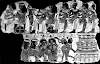
Blind singers, tomb
of Meryre I
(no.4) at El-Aamarna,
south wall of the pillared
hall
|
The boundaries of Akhetaten were marked by a chain of stelae
surrounding the area on both banks of the river . On the west bank, the
northernmost of these (Stela A) is at Tuna el-Gebel, while on the east bank Akhetaten extended
close to the tombs of el-Sheikh Sa’id (Stela X).
Although it has produced a number of famous works of art, for the
visitor el-‘Amarna is disappointing because there are hardly any buildings
standing. The spoliation started soon after the town was abandoned, with the
removal of stone to building sites nearby, notably to el-Ashmunein.
Except for the side facing
the river , the plain of el-‘Amarna is entirely enclosed by rock cliffs,
occasionally broken by wadis. The bay is some 10 km long and about 5 km deep, but the town itself
occupies only the area closest to the river. Its most important central part
contained the Per-Aten-em-Akhetaten (“The Temple of the Aten in Akhetaten”),
knwn as “The Great Temple,” and the official state building, “The Great
Palace. “The main features of the latter were (1) the “State Apartments,”
formed by a series of courts and columned halls and built of stone, (2) the
“Harim with adjacent servants’ quarters, and (3) the so-called “Coronation
Hall.” Akhenaten’s private residence was across the road from “The Great
Palace” and was connected with it by a bridge . Close to it was the “Record
Office,” which in 1887 produced the cuneiform diplomatic correspondence
(‘Amarna Letters) exchanged between Amenophis III, Akhenaten and Tut’ankhamun,
and rulers and vassals of Palestine, Syria, Mesopotamia and Asia Minor. This
conglomeration of official buildings was surrounded by private houses,
workshops, sculptors’ studios etc., on the north and south sides.
The names of the owners of many of the houses are known from
inscribed architectural elements found during their excavation (the sculptor
Thutmose, the vizier Nakht and others).
Neat the southern extremity of the ‘Amarna bay there was the
Maru-Aten, a group of buildings which also included a lake, a kiosk on an
island and flower beds, and was adorned with painted pavements. At the north
end of the bay there stood the “North Palace” and perhaps yet another royal
residence. However, the exact purpose of some of el-‘Amarna’s buildings is
still a matter of conjecture.
 |
|
Painting from the
king’s private
residence showing two
small
daughters of
Akhenaton
Oxford Ashmolean
museum
|
Amarna’s officials had their tombs cut in the cliffs encircling the
plain. Thebes and Saqqara apart, el-‘Amarna is the only site which can be
described as a New kingdom necropolis of importance. The tombs form two large
groups, and their plan is similar to that of the Theban tombs of the 18th
Dynasty : (1) an outer court, (2) and (3) a long ha;; and a broad hall, both
sometimes with columns, (4) a statue niche.
The decoration was in sunk relied. The date is betrayed by the novel
subject-matter and the unusual artistic conventions of ‘Amarna art. How many of
these tombs were actually put to use is not clear ; some of their owners had other
tombs made elsewhere, Tomb No. 25 of the south group was prepared for Aya, who
later became the penultimate king of the 18th Dynasty and was buried in a tomb
in the Valley of the Kings at Thebes (No.23). For his own family tomb Akhenaten
chose a ravine about 6 km
from the mouth of the large Wadi abu Hasah el-Bahri, which it joins .
El-Sheikh Sa’id
The tombs of the men governing the hare nome (15th Upper Egyptian
nome) during the 6th Dynasty were cut in the steep cliffs named after a Muslim
saint buried in the area. Their importance is greatly enhanced by the absence
of contemporary evidence from el-Ashmunein, the capital of the nome .
Deir el-Bersha
 |
|
Scene in the tomb of
Djehutihotpe at Dier El-Bersha
|
Almost opposite the town of Mallawi, on the east bank of the Nile a
valley called the wadi el-Nakhla breaks through the cliffs and runs in a
southeasterly direction. Apart from limestone quarries of various periods it
contains a number of rock-cut tombs.
Some of them belong to the nomarchs of the 15th Upper Egyptian nome
and date to the 12th Dynasty, though several are probably a little earlier .
The name Deir el-Barsha, by which the site is known, is from that of the
village west of the wadi .
The most spectacular of the
tombs was made for the “Great Overlord of the hare nome” called Djehutihotpe,
who lived during the reigns of Amenemhet II, Senwosret II and Senwosret III.
The chapel consists of a deep portico of two columns with palm capitals, and
the inner room with a niche at the back. The decoration is executed in very low
relief, at places only in paint. The west wall of the inner room bears the
famous scene of the transport of a colossal statue from the alabaster quarries
at Hatnub.
The tombs were excavated by expeditions of the Egypt Exploration
fund (P. E. Newberry and others) between 1891 and 1893,
and the combined mission of the Harvard University and the Boston Museum of
Fine Arts in 1915 (G. A. Reisner and others).
Source: Baines and Malek, Atlas of Ancient Egypt
Source: Baines and Malek, Atlas of Ancient Egypt


0 Comments